Hō Mai Ka Pono Project
TRADITIONAL UNDERSTANDINGS OF TIME AND PLACE
with Tom Penna and Dr. Manulani Aluli Meyer
"In the traditional reality you always have a sense of where you are placed in time. You feel connected to everything. You have an intimate understanding of the movement of life across the entire island and beyond... One of the ways of awakening these understandings is to introduce them to the modern school setting. This can done for virtually every subject"
Connecting Math, Science, Traditional Place Names and Mo‘olelo in a Single Lesson
|
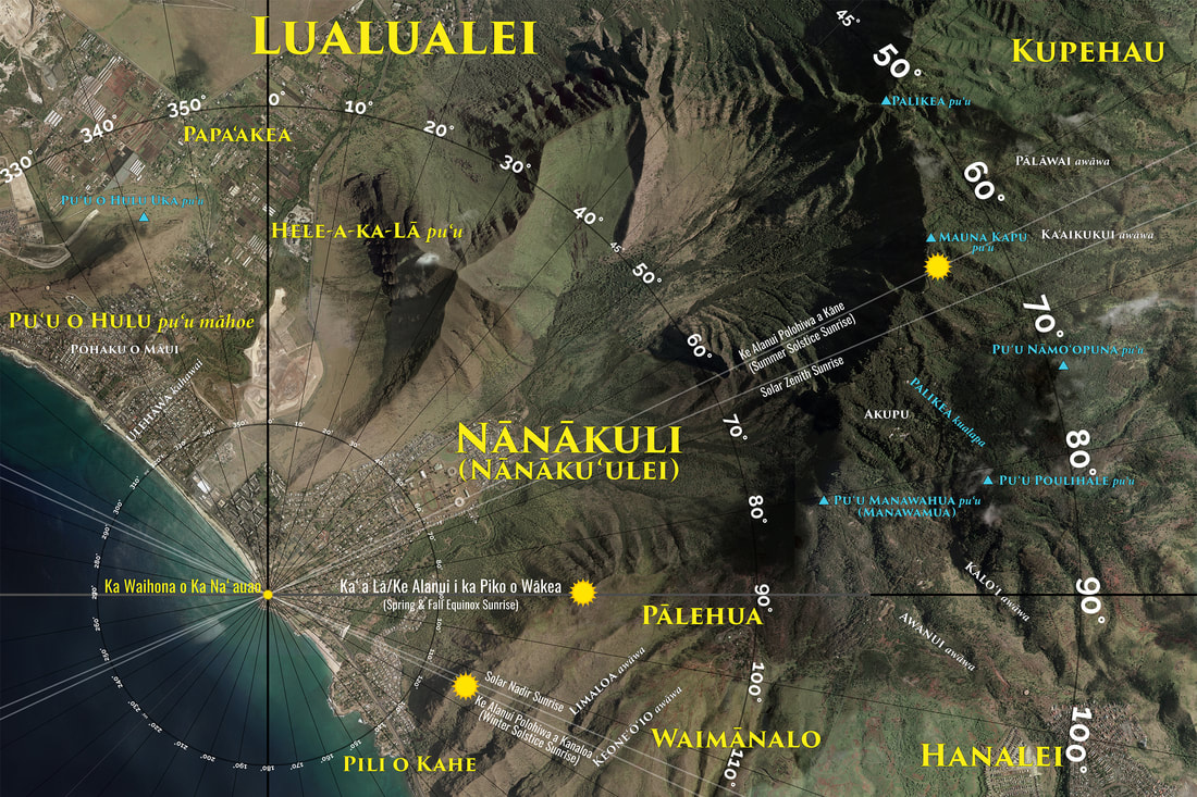
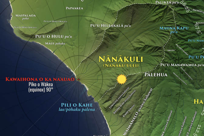
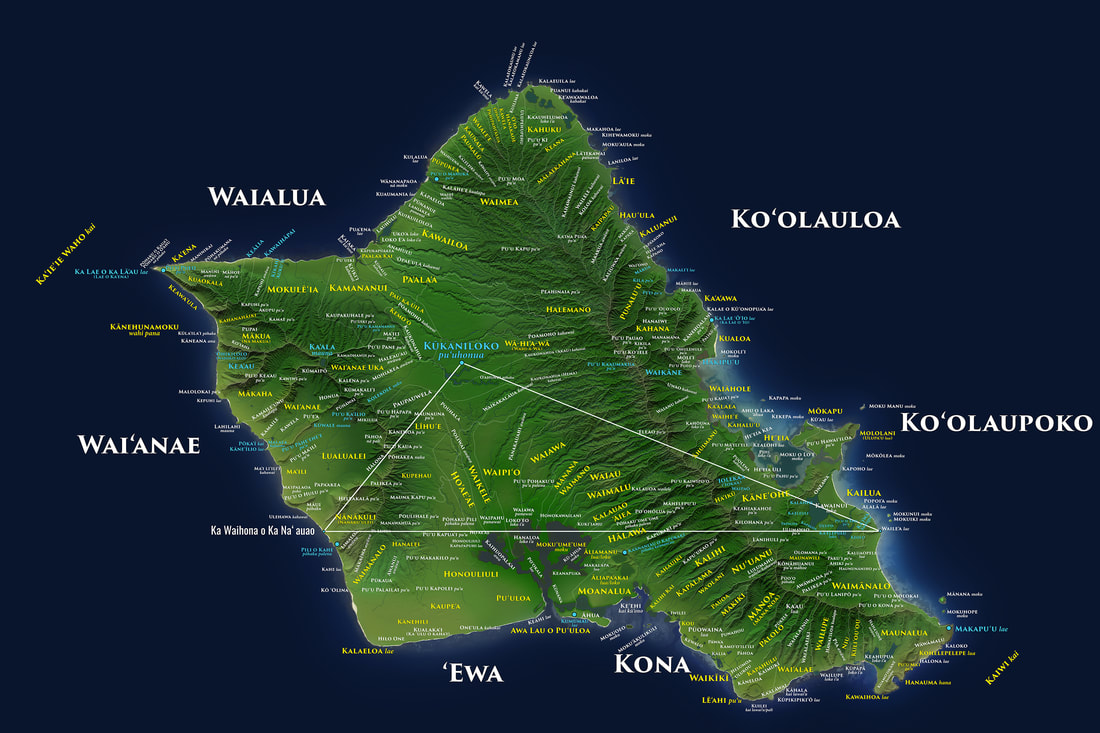
Ka Waihona o Ka Na‘auao is a Hawaiian Charter School in Nānākuli. The above map shows a small portion of math, science and geography related learning opportunities seen by simply standing on school grounds and knowing what to look for. This adds a new dimension to understanding traditional place names and mo‘olelo ("history") The above image can be printed up to 10ft. wide and used as a floor map. 2x3ft. posters can be used for many in class activities.
|
Fundamental Principle of Time and Place
Traditionally, the entire community moved in sync with the moon, sun, celestial bodies, flow of water and natural features. All of this intuitive knowledge is the backbone for innumerable educational projects. STEM, science, math, photography and video become legitimate translations of the traditional world-view. Social Studies and geography are brought to life through the traditional world view.
Build Curriculum From What is Directly Visible
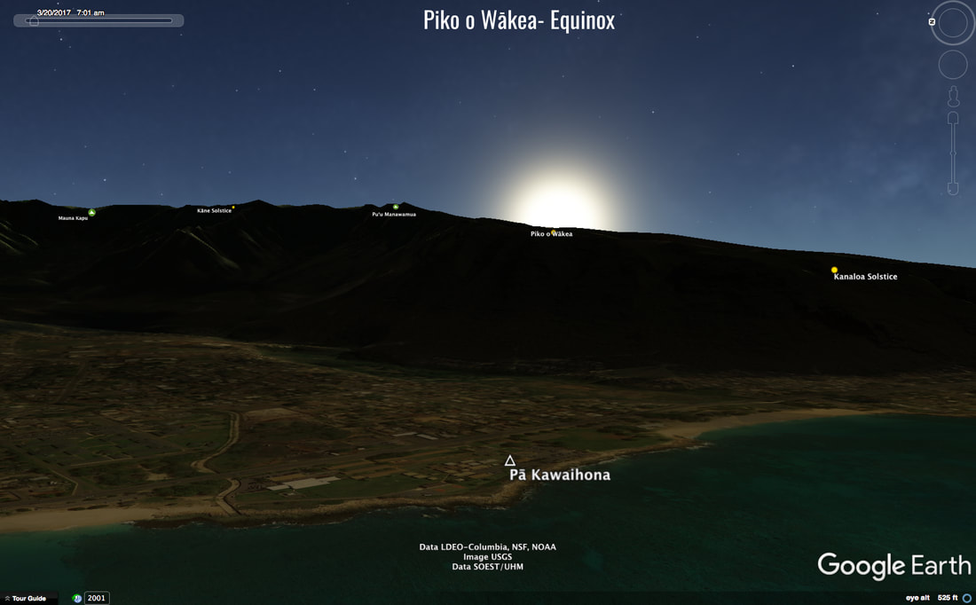
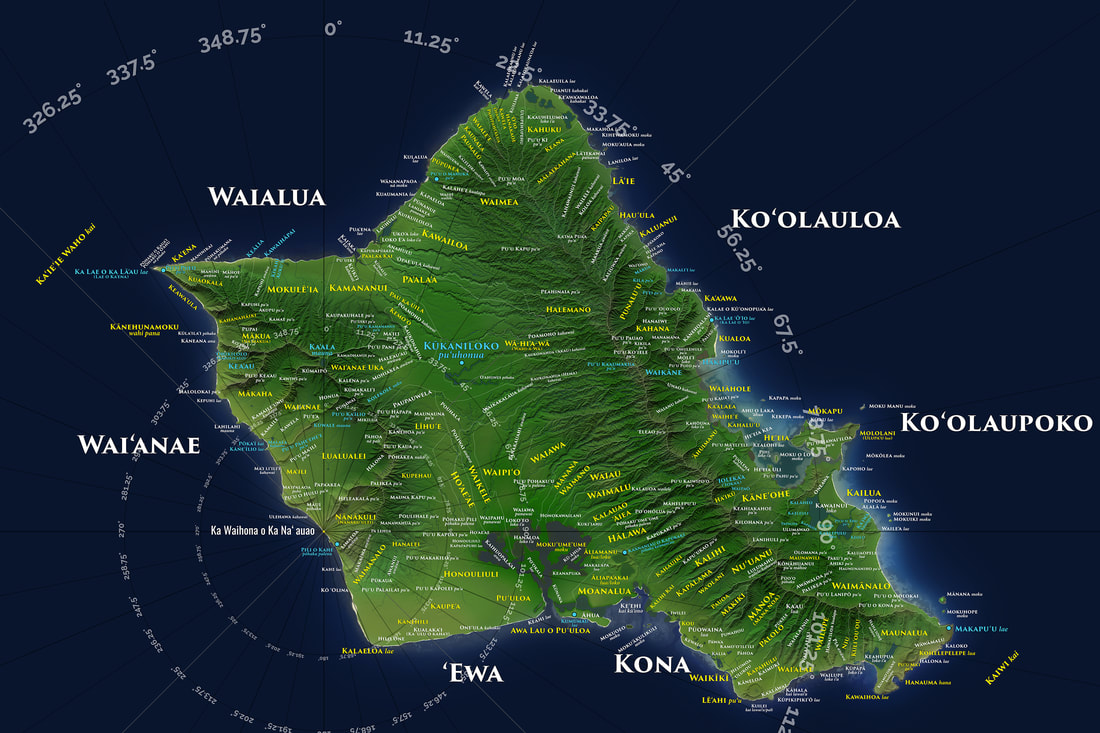
The marking of time is the relationship of sun, stars and moon to geographic features as seen in any geographic location. As the sun crosses the
Piko o Wākea (celestial equator) during the spring and fall equinoxes it rises at 90°. This is the equinox in relation to Ka Waihona school.
Piko o Wākea (celestial equator) during the spring and fall equinoxes it rises at 90°. This is the equinox in relation to Ka Waihona school.
Understanding the Timeless Blue-Print of Place
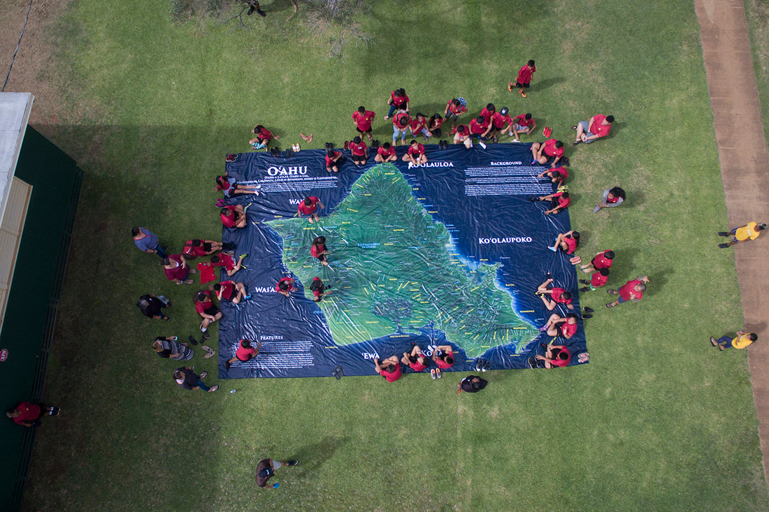
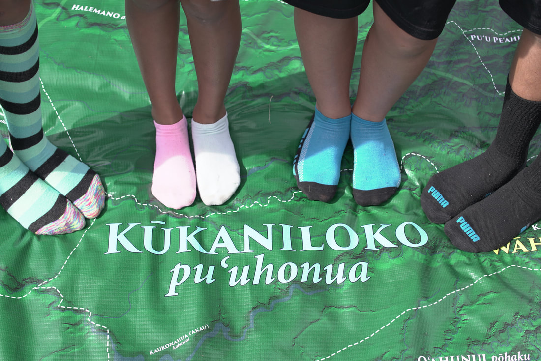
An essential ingredient of relationship building within the community, school and individual. Mapping traditional place names, flow of water, original coastlines to understand a timeless relationship. 20x30ft. Floor maps provides endless learning opportunities.
Place Names Sustain Traditional Mo‘olelo
Understanding the hidden meanings behind place names is its own science. Place names not only connect to what is literally visible, but also portray celestial phenomena and life lessons.
Understanding Place Name Connections Across O‘ahu
Ka Waihona Charter School (Nānākuli, Wai‘anae) is directly west of Waile‘a (Ko‘olaupoko). When both of these places are connected to Kūkaniloko (the piko/center of O‘ahu) a triangle is formed. The triangle has three vertices Ka Waihona (52°), Waile‘a (22°), and Kūkaniloko (106°). Mount Ka‘ala is directly north of Ka Waihona. Waikīkī is at 109°, Kānehoalani at Kualoa is at 63°.
Complete Breakdown of the Traditional Classroom
Translated into Modern Math, Science, Geography, Photography & Web Design Applications
Custom Curriculum Design for Each School, Community and Learning Center
Translated into Modern Math, Science, Geography, Photography & Web Design Applications
Custom Curriculum Design for Each School, Community and Learning Center
go to learning tools

